


Guide to the Quehanna Trail
Ben Cramer
Non-Fiction
Master the wild beauty of Pennsylvania’s most remote landscapes with this definitive, point-by-point guide to the 73-mile Quehanna Trail loop. Definitive Navigational Authority: This comprehensive guide provides meticulously verified, point-by-point navigation for...
Out of stock
9798888194508
Master the wild beauty of Pennsylvania’s most remote landscapes with this definitive, point-by-point guide to the 73-mile Quehanna Trail loop.
-
Definitive Navigational Authority: This comprehensive guide provides meticulously verified, point-by-point navigation for the entire 73.73-mile Quehanna Trail loop, including 14 recent relocations and updated mileage to ensure hikers have the most accurate data available.
-
Unrivaled Regional Depth: Beyond the main loop, the book offers detailed logistics for five affiliated trails—the Cut Off, West Cross Connector, East Cross Connector, Old Sinnemahoning, and Bear Run Trails—enabling hikers to customize everything from short day trips to ambitious multi-day expeditions.
-
Essential Wilderness Logistics: Every critical detail is covered, from reliable water source evaluations and primitive camping regulations to precise GPS coordinates for official parking access points across Clearfield, Cameron, and Elk Counties.
-
Immersive Natural History: Readers gain a deeper connection to the landscape through expert commentary on the region’s unique ecosystems, including its rare high-plateau meadows, the history of the "Corporation Dam," and insights into local wildlife like the Pennsylvania elk herd.
- Safety Considerations: The guide prioritizes hiker safety with specific warnings regarding challenging wet crossings, seasonal hunting considerations, and practical advice for navigating the remote Quehanna Wild Area.
The 73.7-mile Quehanna Trail is a loop through portions of two state forests and three counties in north-central Pennsylvania. The main trailhead is at Parker Dam State Park in northern Clearfield County. The trail passes through two State Game Land districts, and for 34 miles, it traverses the Quehanna Wild Area. It also passes near the industrial near-ghost town of Piper and visits several areas that are still recovering from a severe tornado outbreak in 1985. The QT is the one Pennsylvania long-distance backpacking trail on which hikers are most likely to see elk in their native habitat. The Quehanna Trail’s main loop includes three different cross-connector trails – the Cutoff Trail, the West Cross Connector, and the East Cross Connector – that can be used to form several different sub-loops. The Old Sinnemahoning Trail departs from the northeastern segment of the main trail and heads to the village of Wyside where, with less than two miles of road walking, hikers can reach the western terminus of the Donut Hole Trail.
Review:
Ben Cramer's Guide to the Quehanna Trail distinguishes itself from the work of his peers through a meticulous, data-driven approach that prioritizes modern accuracy over legacy estimates. While many regional guidebooks rely on outdated map measurements, Cramer’s 2026 edition is built upon exhaustive on-the-ground inspections conducted in 2025.
The most significant differentiator is Cramer’s technical rigor. He explicitly critiques popular user-generated platforms like AllTrails for "GPS drift" and inaccurate measurements from consumer-grade devices. In contrast, Cramer utilizes professional mapping software and a traditional measuring wheel—the industry standard for accuracy—to verify every mile of the 73.73-mile loop. This precision is vital for the Quehanna network, where Cramer identified fourteen relocations and a significant reroute near Medix Run that rendered previous guides and state-issued maps obsolete.
Cramer also displays a unique professional synergy with his predecessors. Rather than replacing the historical and ecological depth of veteran trail builder Ralph Seeley, Cramer positions his guide as a "Strategic Partner" to Seeley’s Greate Buffaloe Swamp. He provides specific page citations to Seeley’s work for hikers seeking deep historical context, allowing his own guide to focus on high-resolution logistics, such as current water quality ratings (ranging from "excellent" to "poor") and the specific condition of footbridges, such as the one recently destroyed by a flash flood at Trout Run.
This "mentor-like" persona—combining a passion for the trail with a scientist’s demand for data—makes Cramer’s guide an essential artifact for the serious backpacker. It offers a level of quiet dependability that is often missing in broader, surface-level hiking anthologies.--The Publisher
Author: Ben Cramer
Page Count: 134
Trim Size: 6 x 9
Publish Date: May 20, 2026
Imprint: Catamount Press
Genre: Trail Guide
SPORTS & RECREATION / Hiking
TRAVEL / United States / Northeast / Middle Atlantic (NJ, NY, PA)
You might also like ...
-
 A Week in the Blue Mountains- The Record of a Happy Outing - From June 14...- The Record of a Happy Outing - From June 14 to June 22, 1914, Henry Wharton Shoemaker and his wife, Mabelle Ruth Ord Shoemaker, traversed the Blue Mountain by carriage and on horseback, startin...
 -
 Guide to the Pinchot Trail SystemThe 22.2-mile Pinchot Trail is an orange-blazed...The 22.2-mile Pinchot Trail is an orange-blazed loop through Pinchot State Forest in southern Lackawanna County. The trail was formed from previously existing trails and a few new connectors in the...
 -
 Guide to the Thunder Swamp TrailThe Thunder Swamp Trail (TST) is an 18.3-mile l...The Thunder Swamp Trail (TST) is an 18.3-mile loop in Delaware State Forest, in southern Pike County. The main loop is bisected by PA 402, and the official trailhead is at the trail’s southern cros...
 -
 Guide to the Old Loggers PathThe Old Loggers Path (OLP) is a great walking p...The Old Loggers Path (OLP) is a great walking path for beginner and experienced hikers alike. The looped trail explored the Loyalsock State Forest, in Sullivan County, Pennsylvania, for 27.8 miles....
 -
 Guide to the Allegheny Front TrailThe Allegheny Front Trail is a 42-mile loop tra...The Allegheny Front Trail is a 42-mile loop trail in Moshannon State Forest in western Centre County, Pennsylvania, that roughly circles Black Moshannon State Park. The trail visits several dramati...
 -
 NewThe Traveler's Guide to Chincoteague and AssateagueThe Islands of Chincoteague and Assateague are ...The Islands of Chincoteague and Assateague are travel destinations like no other. NEW EDITION FOR 2024 Many visit these islands on Virginia’s Eastern Shore to see the wild ponies made famous by th...
 -
 Journey by the BookA Guide to Tales of Travel Your compass is poin...A Guide to Tales of Travel Your compass is pointing at the magnetic field of travel. Journey by the Book is a tool enabling the pathfinder—whether tenderfoot or veteran scout—to explore uncharted s...
 -
 Beyond the Sunset Volume 2Expanding My Horizons Patagonia, Uganda, and p...Expanding My Horizons Patagonia, Uganda, and places far beyond: How a bookworm turned flower child turned healthcare executive found joy in traveling the world. Structured in a series of essays an...
 -
 Beyond the Sunset Volume 1Adventures Outside My Comfort Zone From Woodst...Adventures Outside My Comfort Zone From Woodstock to the Okavango. How a bookworm turned flower child turned healthcare executive found joy in traveling the world. Structured in a series of essay...
 -
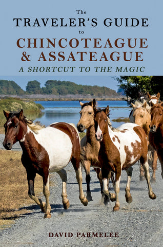 The Traveler's Guide to Chincoteague and AssateagueThe Islands of Chincoteague and Assateague are ...The Islands of Chincoteague and Assateague are travel destinations like no other. Many visit these islands on Virginia’s Eastern Shore to see the wild ponies made famous by the children’s classic ...
 -
 NewRunning from COVID in our RV CocoonA couple of grizzled old geezers leave for a mo...A couple of grizzled old geezers leave for a months-long RV trip in February 2020. But they are about to hit a bump in the road. Gerri Almand and her husband Michael have been living part-time in ...
 -
 Home Is Where the RV IsWill two more years of RV travel turn a relucta...Will two more years of RV travel turn a reluctant RV wife into a minimalistic nomad at last? In this follow-up to her award-winning memoir The Reluctant RV Wife, Gerri Almand hits the road with her...
 -
 The Road to Villa Pageby Cynthia & William Royce A He Said/She Sa...by Cynthia & William Royce A He Said/She Said Memoir of Buying Our Dream Home in France The Road to Villa Page: A He Said/She Said Memoir of Buying Our Dream Home in France is the first in a se...
 -
 Ponies Westby Jeff Pappas A True American Adventure A thr...by Jeff Pappas A True American Adventure A throwback to the classic Old West adventure book—Ponies West is the true story of two Connecticut cowboys who dared to set the modern-day world record by...
 -
 Where the Tree Frogs Took MeHow encounters with strangers shaped a life of ...How encounters with strangers shaped a life of travel and beyond ~ We are all looking for ways to make our lives meaningful and often turn to those in our inner circles and communities for the dire...
 -
 The Reluctant RV WifeFollow a reluctant wife and her excited husband...Follow a reluctant wife and her excited husband through two humorously-conflicted years of RV travel. He wanted to go; she wanted to stay. They both learn, grow, and change as a new level of freedo...
 -
 Captain Hooter's Connoisseur's Guide to Amsterdam CoffeeshopsOne man… on a mission… Go to every single coffe...One man… on a mission… Go to every single coffee shop in Amsterdam in search of the “best of the best.” ~~~ Multi-year Cannabis Cup judge and Worldwide Herbal Connoisseur, “Captain Hooter” has meti...
 -
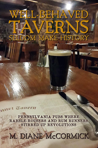 Well-Behaved Taverns Seldom Make HistoryPennsylvania Pubs Where Rabble-Rousers and Rum ...Pennsylvania Pubs Where Rabble-Rousers and Rum Runners Stirred Up Revolutions Take a pub crawl through 12 Pennsylvania taverns with rebellious pasts, where the stakes were high and the rum was flow...
 -
 Let Me Carry You Homeby Susan Kiskis A decade ago, a group of bald m...by Susan Kiskis A decade ago, a group of bald men in saffron robes made music under a yellow tent on Toronto Island. A large Indian community joined them, offering Susan and her family free food. L...
 -
 Born Fire Dragonby Susan KiskisSusan always knew her family was...by Susan KiskisSusan always knew her family was different. Whether it stemmed from an unusual and often complicated childhood, or from her experiences with the “other side,” Susan lived on the outs...


Customer Reviews